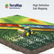
TerraMap enables you to understand your soil and make the most of precision technology
How it works
- The field is scanned with TerraMap and reference soil samples taken.
- TerraMap uses passive, gamma-ray detection technology to measure Caesium, Uranium, Potassium and Thorium isotopes.
- The raw scan, soil data and soil samples are processed for high resolution maps of all common nutrient and physical soil properties, at 800 sample points per hectare.
Why you should use TerraMap
- The highest resolution maps available at 800 sample points per hectare.
- Highlights variations in the soil for clearer insight of field performance.
- Create tailored management and variable rate plans quickly and easily.
- Up to 48 map soil properties available – understand your soil and why it performs as it does.
- Not affected by soil moisture, compaction, crop cover or cultivation state. A much wider scanning window than other systems.
- Application maps are compatible with a wide range of software.
- Repeatable, consistent, and reliable results proven across many years and hectares.
Why have one sample point per hectare when you can have 800?
TerraMap Carbon
TerraMap is the first carbon mapping service to provide accurate baseline measurement of organic and active carbon in the soil.
Why is it important to measure carbon?
While pressure to manage carbon is only increasing, as an industry UK farming is in a unique and enviable position as farming activities can make positive changes to carbon, which most other industries are not able to do.
A reduced carbon footprint can only be achieved through more efficient fertilisers, different technologies, better soil carbon management or considering the energy used in storage, so it’s a win– win on all levels.
There are 6 TerraMap services:
The Standard service measures 10 soil properties:
- P, K, Mg, pH
- Clay%, Sand%, Silt%, Silt/Clay Fraction, Texture
- Elevation
The Standard + OM service measures everything in Standard, plus:
- Organic Matter
The Premium service measures everything in Standard + OM, plus:
- Cation Exchange Capacity, Elevation, Plant Available Water Index
- Calcium, Manganese, Sodium, Boron, Copper, Molybdenum, Iron, Zinc, Sulphur
The Standard Carbon service measures everything in Standard + OM, plus:
- Organic Carbon (% & t/ha)
The Premium Carbon service measures everything in Premium, plus:
- Organic Carbon (% & t/ha), Active Carbon (% & t/ha), % of Carbon that is active
Producing 27 high-definition soil property layers.
The Gold service measures soil’s “plant available” and “non-readily available” nutrients, allowing greater understanding of soil dynamics.
Analyse your actual soil reserves more accurately than ever before:
- Understand your soil’s ability to support crop growth
- Detailed knowledge of why the soil behaves as it does
- Better informed management decisions
TerraMap is powered by SoilOptix® Technology
SoilOptix® and SoilOptix and Design® are the registered trade-marks of SoilOptix Inc. and are used under license.

 Download