Scout App Features
The Omnia Scout App provides a more professional, standardised way of making, recording and sharing crop notes from the field.
With increasing scrutiny of all crop inputs, particularly insecticides, the app also provides a digital record to help demonstrate the rationale behind input decisions and potentially allow more targeted treatment of crops.
Location markers can be tagged to any notes or pictures manually or by using the phone’s GPS, allowing that area to be revisited and monitored over time, and targeted management plans to be developed in Omnia if required.
Likewise, users can analyse data, such as satellite biomass imagery or yield maps, in Omnia and highlight specific areas for further investigation and “ground-truthing”.
Now Available for both Android and iOS!
Download it now for FREE from the app store.
What People Say
Latest Updates
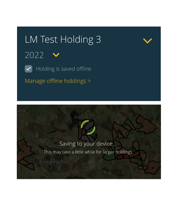
Offline Mode
We understand that not everyone has good mobile data coverage in rural areas, with this in mind you can now save holdings offline in the Scout App. When back online the app will then sync any changes back to Omnia and vice versa.
We have rebuilt the Omnia Scout to include new functionality to edit existing field and crop boundaries, create new map layers and editing exiting ones.
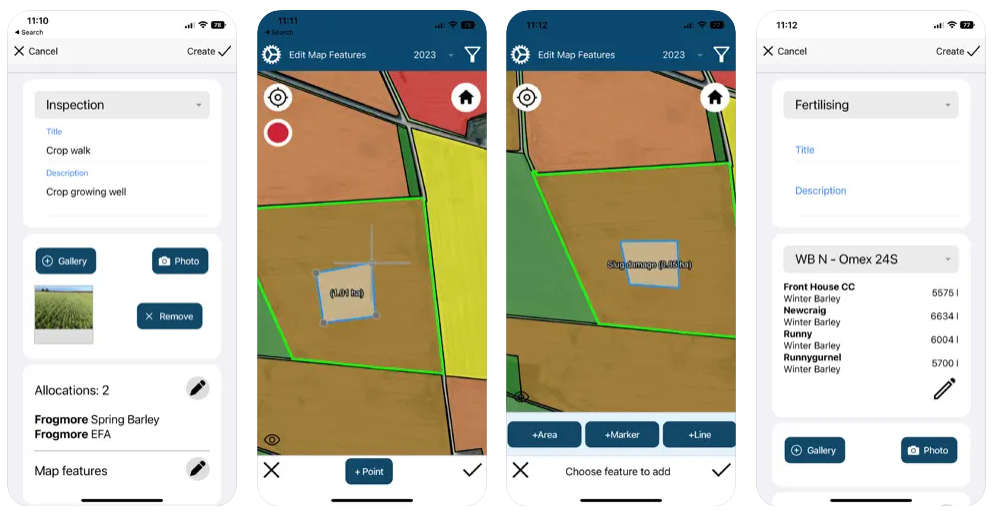
We have also built a new Field Diary mode within the app to log field inspections and operations within the field.
More Details
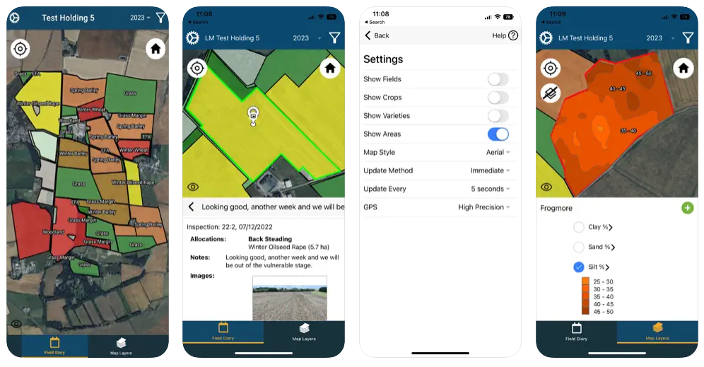
Fields & Crops
View your holding on your mobile devices.
Field Diary
Create & view diary entries such as field operations and inspections.
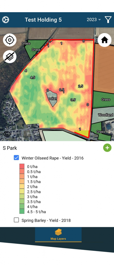
Map Layers
View and create map layers while out in the field.
Improved User Interface
The app looks and feels more like the main Omnia platform.
Quicker data entry
Logging diary entries has been made much easier.
New ‘Filter’ button
Easily filter the map to help focus on what you want to view.
New map feature options
Draw a line and auto-log points to capture areas of interest.
Speed improvements
Swapping between holdings is now much quicker.
Map layers
Additional tools to help when creating zone based maps.
Crop map – Areas & Varieties
See areas and varieties on the map, helpful as a quick reference when you are out in the field.
Locate Me button
Quickly centre the map onto your current location, particularly useful where you have large holdings or land in different locations.
Inspections/Operations – Multiple Pictures
Save multiple pictures to a field inspection or operation. This allows you to capture several different images to annotate your diary entry.